Ha Giang Loop itinerary: 4 days around the loop, day by day

The Ha Giang Loop is a road trip of about 370 km around the Dong Van Karst Plateau, ridden in four days by most visitors, with a night in Yen Minh, Dong Van and Du Gia. Each day covers 85 to 100 km, with stops every half hour or so. Unless your licence is valid in Vietnam, ride pillion behind an easy rider on a tour or hire a car and driver. Start in Ha Giang city after a night's sleep, not off a 3 a.m. bus. Go between September and November, when the rain eases. Book first the tour or bike, and through it the border-area permit foreigners need, which only a sponsor can arrange.

On this page

How many days

  • 1 day: Day 1

    Only a day? Ride Day 1 as far as Heaven Gate and the Twin Mountains, 46 km from Ha Giang city, and come back the same way; you miss the loop itself.

  • 3 days: Days 1 to 3

    Three days: ride Days 1 and 2, then on Day 3 cross Ma Pi Leng to Meo Vac and return to Ha Giang through Yen Minh, about 165 km, a long day; you skip Du Gia.

  • 4 days: Days 1 to 4

    The full four-day loop as most tours ride it: Yen Minh, Dong Van and Du Gia, then back to Ha Giang.

Day 1

Ha Giang city to Yen Minh, about 100 km

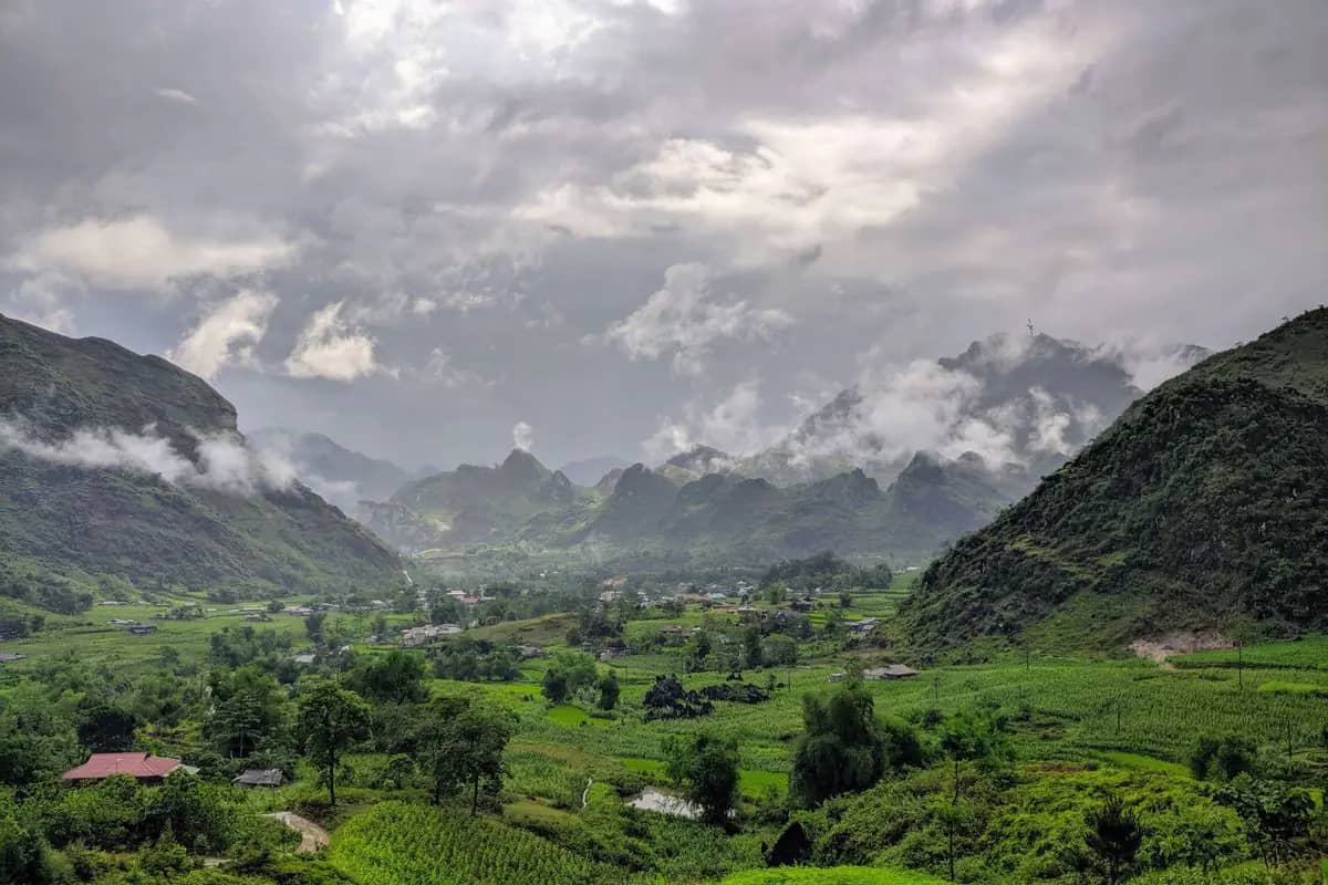
Up the switchbacks of Bac Sum and over Heaven Gate in the morning light, lunch in Tam Son, the linen weavers of Lung Tam, then on to Yen Minh for the night.

07:30 to about 18:00 · 8 stops

1234567810 km
Numbers follow the plan below; solid lines by road, dotted on foot, dashed by boat, train or cable car. Map: © OpenStreetMap contributors, Natural Earth.
  1. 07:301
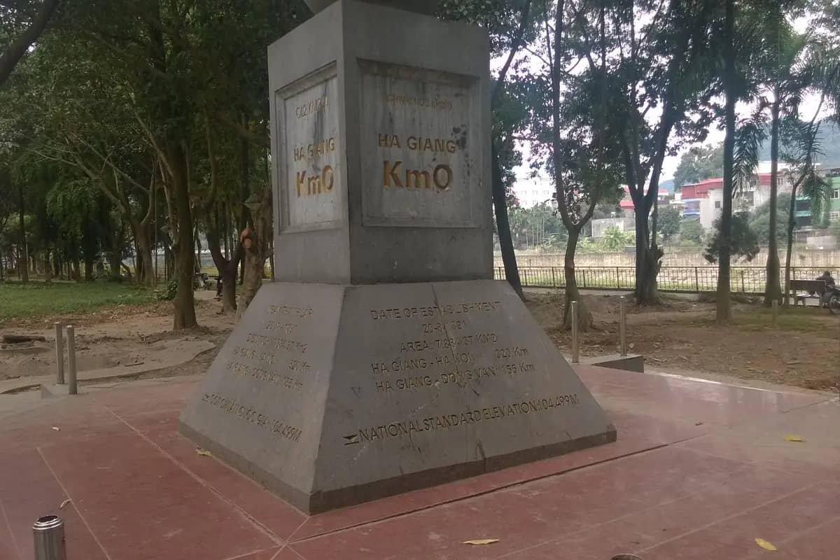
    The grey stone Km0 marker in Ha Giang city, with the distances to Hanoi and Dong Van carved on its base

    Travel · 30 min

    Km 0 marker, Ha Giang city

    Cost: Free

    The 0 km marker on Nguyen Trai street is the official start and end of the loop. Before you leave, check three things with your tour company or rental shop: that your border-area permit is arranged through a sponsor, since entering without one can be fined 500,000 to 2,000,000 dong; that your licence is valid in Vietnam, or that you have an easy rider; and that your bike has working brakes and a helmet. Carry your passport: homestays must declare you to the police.

    Image: Vuong Tri Binh / Wikimedia Commons, CC BY-SA 4.0
    About 20 min by motorbike, 28 km. North on QL4C, about 28 km to the Bac Sum pass viewpoint.

  2. 08:452
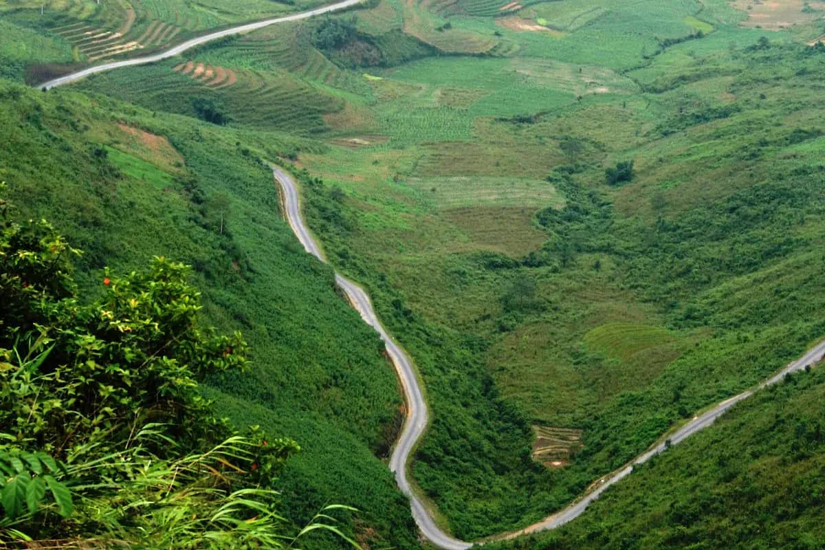
    QL4C winding up through green fields and slopes, seen from the top of the Bac Sum pass

    View · 30 min

    Bac Sum pass

    Cost: Free

    Within half an hour of the city QL4C starts to climb through the switchbacks of the 7 km Bac Sum pass, the first big climb of the loop. Pull in at the viewpoint near the top to look back down the bends you have just ridden. Ride the bends slowly: the road carries trucks and buses as well as tour bikes, and from May to August it is often wet and slippery. Morning mist is common, so keep your lights on.

    Image: Thái Nhi / Wikimedia Commons, Public domain

    About 15 min by motorbike, 18 km. About 18 km on QL4C to Quan Ba, Heaven Gate.

  3. 09:453
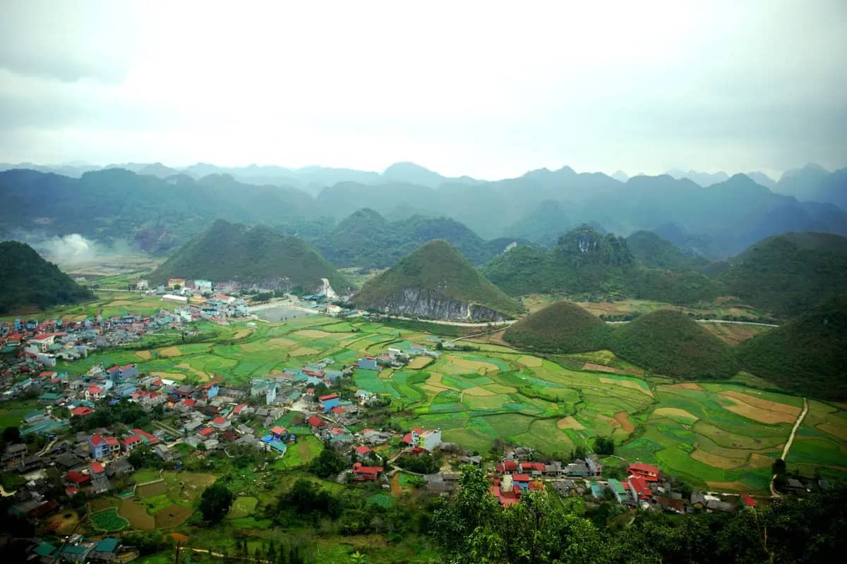
    The view from Quan Ba Heaven Gate over Tam Son town, its rice fields and the rounded karst hills of the valley

    View · 45 min

    Quan Ba Heaven Gate

    Cost: Free; coffee at the lookout cafe priced per drink

    Quan Ba pass, known as Heaven Gate, is 46 km from the city and the first great view of the loop: the valley of Tam Son opens below, ringed by karst. Lonely Planet's writer plans a coffee break and photos at the big lookout here, Cafe Cong Troi. On a clear morning you can pick out the Twin Mountains in the valley below; in fog, wait half an hour before you give up on the view, since it often lifts as the day warms.

    Image: Anh Khac / Pexels

    About 5 min by motorbike, 2.4 km. Down into the valley, under 1 km to the Twin Mountains viewpoint.

  4. 10:404
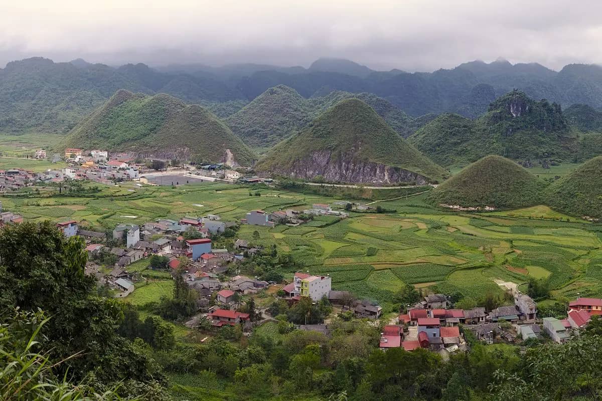
    The two rounded Twin Mountains rising from the rice fields and houses of the Quan Ba valley

    View · 20 min

    Twin Mountains viewpoint

    Cost: Free

    The Twin Mountains, Nui Doi, are two rounded lookalike hills rising out of the flat fields of the Quan Ba valley; the viewpoint on the road down is named Nui Co Tien, the fairy's mountain. It is a quick photo stop on the way into Tam Son. In September the rice in the fields around them turns gold, and from October to November the buckwheat flowers bloom across the plateau, the two sights most riders come in autumn for.

    Image: Sketyl / Wikimedia Commons, CC BY 2.0

    About 5 min by motorbike, 1 km. About 1 km into Tam Son town.

  5. 11:155
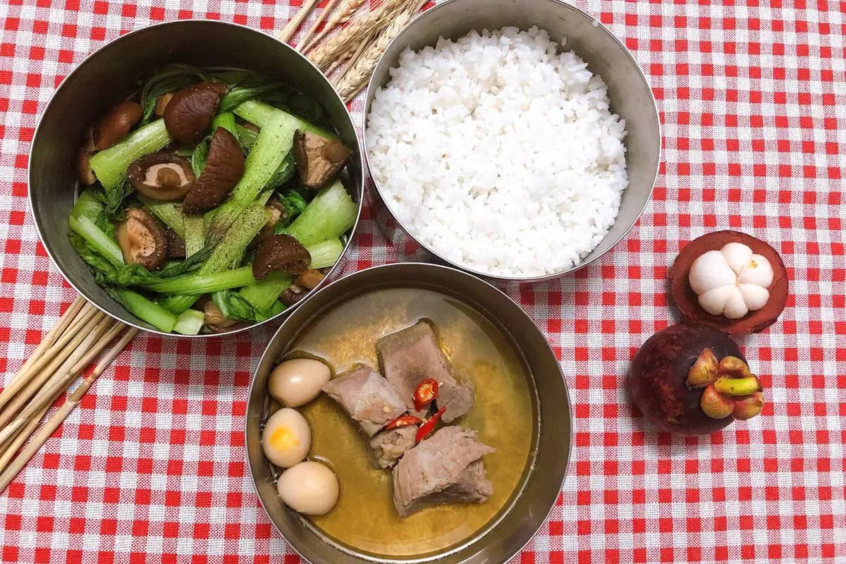
    A simple Vietnamese lunch of braised pork, a bowl of soup and white rice

    Eat · 1 h

    Lunch in Tam Son

    Cost: Prices per dish

    Tam Son, the district town of Quan Ba, is the last proper lunch stop before Yen Minh. Eat what the roadside restaurants have that day: rice with pork or chicken, stir-fried greens and soup, or a bowl of pho. On a tour, lunch is usually included and your guide chooses the place. Fill the tank here too, and buy water and snacks: the next stretch, to Lung Tam and over to Yen Minh, has few towns.

    Image: Bình food_diary / Pexels

    About 10 min by motorbike, 9.6 km. About 11 km east to Lung Tam on QL4C and DT181.

  6. 13:006
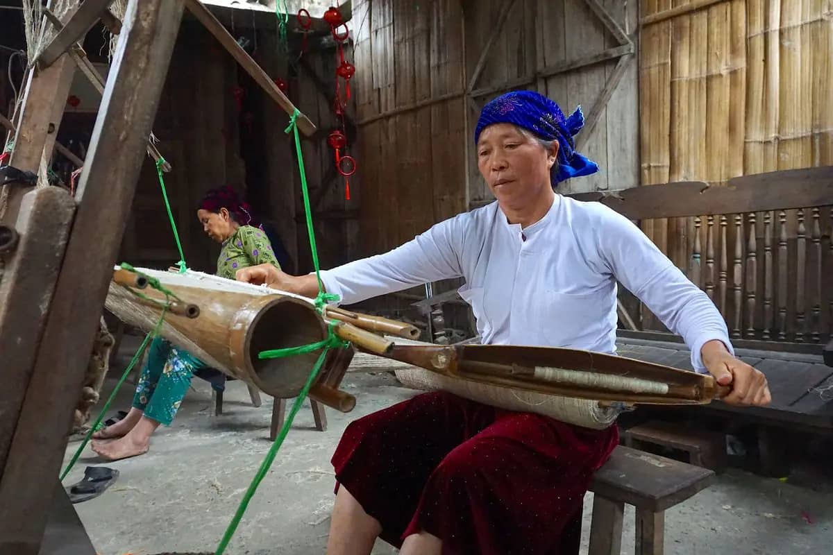
    A Hmong woman in a blue headscarf working a wooden loom at Lung Tam weaving village

    Do · 1 h

    Lung Tam linen cooperative

    Cost: Free to watch; textiles priced per piece

    At the Lung Tam weaving village, Hmong women weave and embroider linen by hand in a courtyard workshop, and you can watch every step. The same textiles are sold all over Vietnam, but buying them here sends more of the money to the women who made them, as Lonely Planet notes. If you would rather see a cave, Lung Khuy, near Heaven Gate, is the alternative, but it needs a steep 20-minute hike; do one, not both, to reach Yen Minh in daylight.

    Image: Duong Nguyen / Pexels

    About 35 min by motorbike, 42.5 km. About 43 km east to Yen Minh.

  7. 15:307
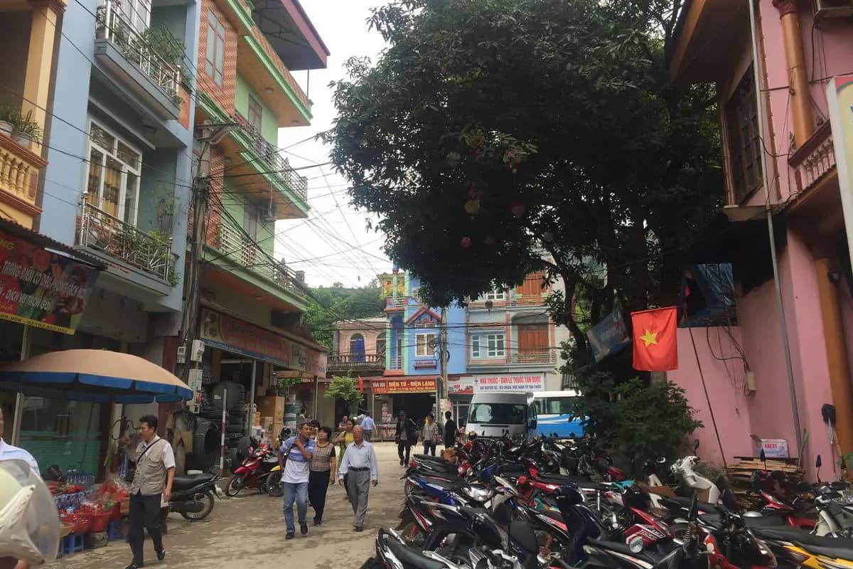
    A street of shops and parked motorbikes in Yen Minh town, a red flag on a pink house

    Travel · 30 min

    Arrive in Yen Minh

    Cost: Rooms from about USD 15 to 50 a night if you ride independently; included on tours

    Yen Minh, the district town, is the usual end of the first day; riding independently, book your room ahead. If you would rather stay in a village, Lonely Planet suggests Nam Dam, a Dao settlement about 8 km from Heaven Gate with a waterfall nearby, but that means a later start tomorrow. Hand your passport to your host on arrival: homestays must declare foreign guests to the police. Get the bike checked if anything rattled on the passes.

    Image: trungydang / Wikimedia Commons, CC BY 3.0

    Walk. Dinner is at your homestay.

  8. 18:008
    A shared home-style meal of rice, stir-fried greens with mushrooms and pork with eggs in broth

    Eat · 1 h 30 min

    Dinner at your homestay

    Cost: Usually included on tours; otherwise ask the price

    On the loop, dinner is usually eaten at your homestay, unless your guide knows a restaurant. Expect shared dishes of rice, meat, vegetables and soup, eaten with your hosts and the other guests. Go easy on any rice wine if you ride tomorrow. Go to bed early: tomorrow climbs to the northernmost point of Vietnam, and from November to March the nights are cold at this altitude, so keep a warm layer and dry socks ready.

    Image: Bình food_diary / Pexels

Day 2

Yen Minh to Dong Van via Lung Cu, about 100 km

The Vuong family palace in the morning, lunch in a Lo Lo village, the Lung Cu flag tower on the Chinese border as the heat eases, and Dong Van's old town and fort before dark.

09:00 to about 18:30 · 6 stops

1234565 km
Numbers follow the plan below; solid lines by road, dotted on foot, dashed by boat, train or cable car. Map: © OpenStreetMap contributors, Natural Earth.
  1. 09:001
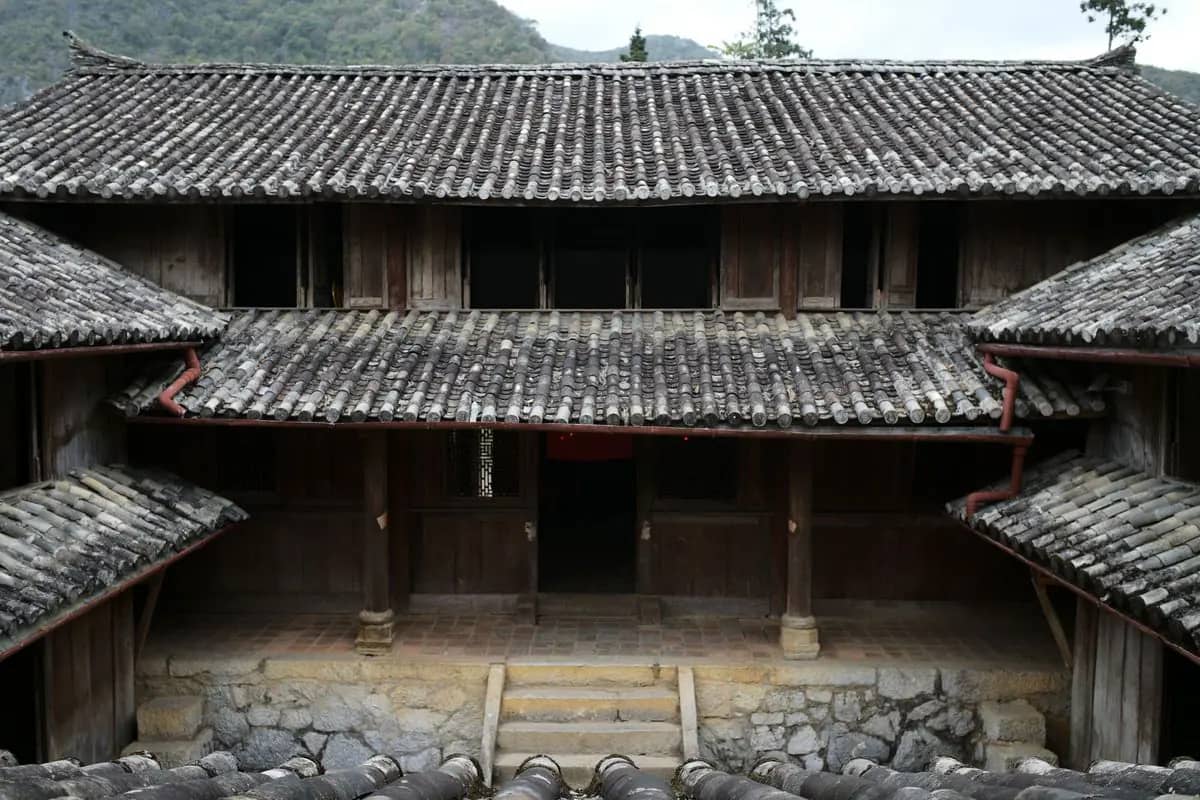
    The wooden halls and grey tiled roofs around a courtyard of the Vuong family palace at Sa Phin

    Sight · 1 h 15 min

    Vuong Palace, Sa Phin

    Cost: Entry ticket at the gate; no official price published, so check there

    Leave Yen Minh early for the 45 km ride to Sa Phin and the palace of the Vuong family, the Hmong kings of this plateau. Vietnam's tourism board describes a wood-framed palace in the traditional Chinese style; Lonely Planet calls it a Chinese-Hmong building put up by the French for a local king in the 1920s, while the tourism board dates it to 1902. Faded photographs of the king and his family hang inside. There are coffee and souvenir stalls in the car park.

    Image: Lucas Tran / Pexels

    About 35 min by motorbike, 35.2 km. About 30 km north towards Lung Cu.

  2. 11:152
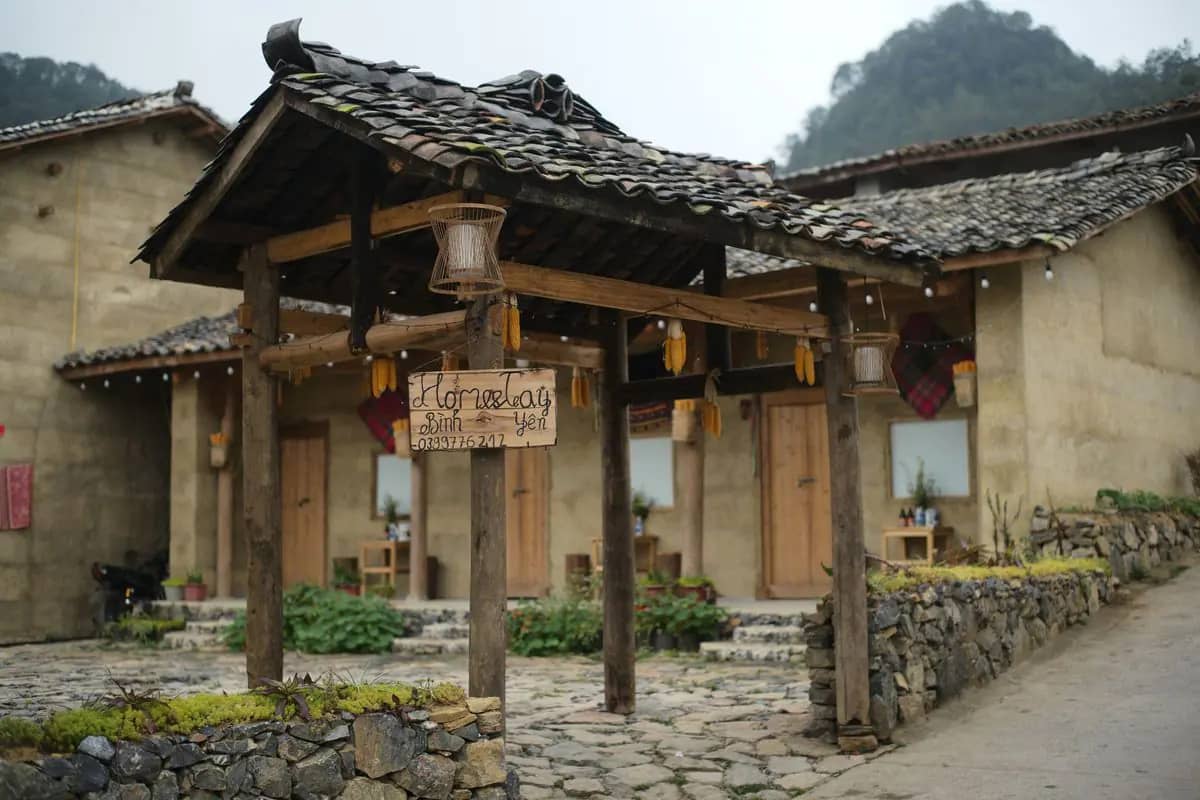
    A homestay of earth-walled houses with a wooden gate and stone paving at Lo Lo Chai village

    Eat · 1 h 30 min

    Lunch in Lo Lo Chai

    Cost: Prices per dish

    Lo Lo Chai is a quiet village of earthen houses just below the flag tower, and many guides like to stop here; its homestays are the places to ask for lunch. Lonely Planet's writer names the Lolo village homestays as a good place to sleep near Dong Van, so if you are riding slowly, you could spend the night here instead and see the tower at sunrise. Rest through the middle of the day: the tower is best in the late afternoon.

    Image: Lucas Tran / Pexels

    About 20 min walk, 1.4 km. Up the lane to the foot of the steps.

  3. 14:303
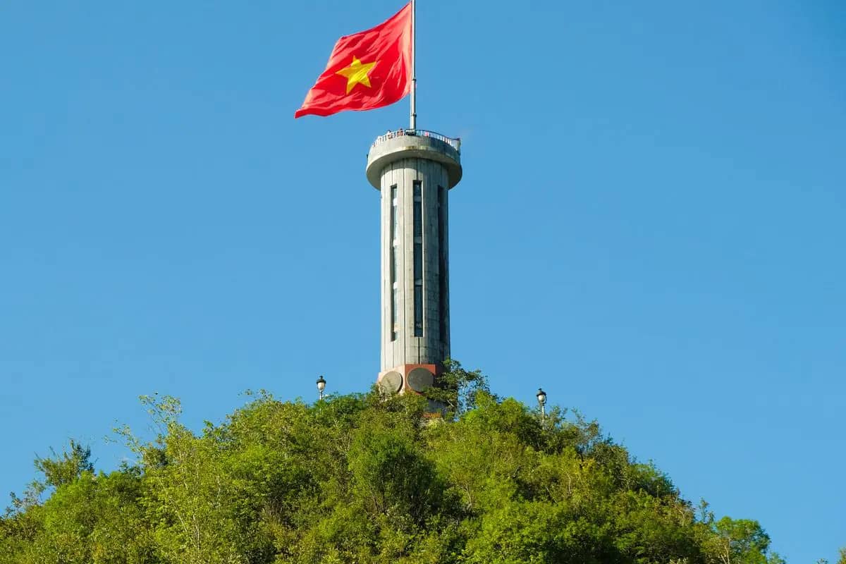
    Lung Cu flag tower on its wooded peak, a large Vietnamese flag flying from the top under a blue sky

    Sight · 1 h 15 min

    Lung Cu flag tower

    Cost: Entry ticket at the gate; no official price published, so check there

    The flag tower stands on a peak by the Chinese border, marking the north of Vietnam, with a huge Vietnamese flag flying from the top. Vietnam's tourism board suggests arriving in the late afternoon, when the heat has eased for the climb. Counts of the steps differ: Lonely Planet gives almost 400 to the base and 140 more inside the 30 m tower, and says the view from the top is worth the climb. Take water and go at your own pace.

    Image: Thai Nguyen / Pexels

    About 25 min by motorbike, 25.8 km. About 26 km south-east to Dong Van.

  4. 16:304
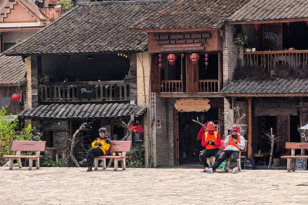
    Old two-storey houses with tiled roofs and wooden balconies on the stone square of Dong Van old town

    Sight · 45 min

    Dong Van old town

    Cost: Free

    Aim to reach Dong Van before sunset, as Lonely Planet advises, and stroll the cobbled lanes of the old town section. The town sits in the middle of the Dong Van Karst Plateau, recognised as a UNESCO Global Geopark in 2010, which covers the four districts the loop crosses: Quan Ba, Yen Minh, Dong Van and Meo Vac. If you are here on a Sunday morning, look in at the colourful weekly market before you ride on.

    Image: Vietnam Hidden Light / Pexels

    About 15 min walk, 1.1 km. North of the old town, a short, steep path to the fort.

  5. 17:255

    View · 45 min

    Dong Van French fort at sunset

    Cost: Free

    A short, steep path just north of the old town climbs to the crumbling French fort, an old observation post with a wide view over Dong Van and the karst around it. Lonely Planet suggests it at sunset after a long day on the road, or at sunrise before the next ride. In mid November the sun sets at about 17:15 here, so go straight up if you arrive late, and take a torch for the way down in the dark.

    About 15 min walk, 1.1 km. Back down into the old town.

  6. 18:306

    Eat · 1 h 30 min

    Dinner at Ethnic House, Dong Van

    Cost: Prices per dish

    Lonely Planet's writer recommends dinner at the Ethnic House Lounge Bar and Hostel in the old town, a reliable inn for tired riders with both Western and Vietnamese dishes, and Phien, a few doors down, for coffee and cocktails. If you are on a tour, dinner may be at your homestay instead. Dong Van is the highest overnight stop on the loop, so from November to March bring a heavy jacket and gloves for the evening.

Day 3

Dong Van to Du Gia via Ma Pi Leng, about 100 km

The best day of the loop: the Sky Path walk and Ma Pi Leng in the morning light, a boat on the Nho Que river below the pass, lunch in Meo Vac, then the long ride south to Du Gia and its waterfall.

07:30 to about 18:30 · 6 stops

12345620 km
Numbers follow the plan below; solid lines by road, dotted on foot, dashed by boat, train or cable car. Map: © OpenStreetMap contributors, Natural Earth.
  1. 07:301
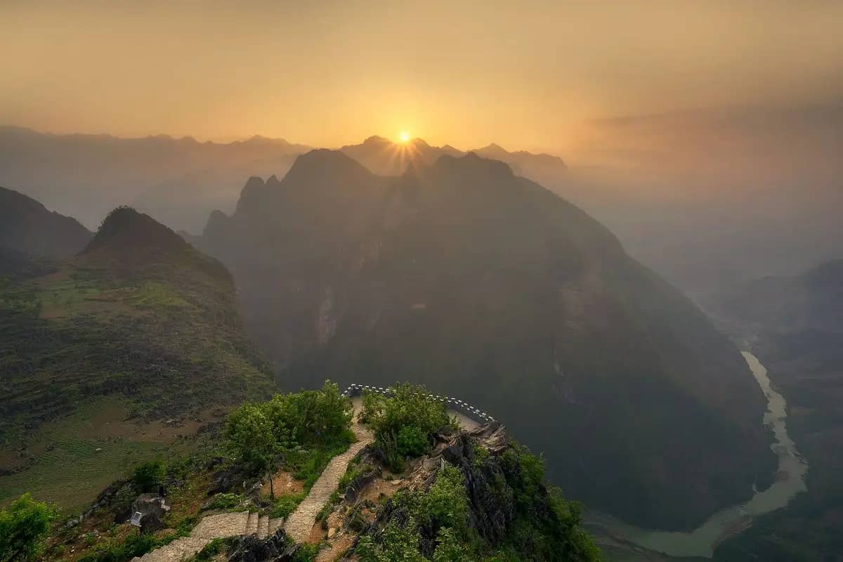
    A stone path running along a clifftop at Ma Pi Leng at sunrise, the Nho Que river far below

    Do · 1 h 30 min

    Youth Volunteers Monument and the Sky Path

    Cost: Free

    About 8 km from Dong Van on QL4C, the monument to the young volunteers who died building the mountain roads marks the start of the Sky Path. The whole walk takes about 90 minutes and climbs a few hundred metres to the White Cliff and Tu San viewpoints; a shorter version goes only to the first summit, Mom Da Tu Than, one of the best photo spots of the loop. Watch your footing on the cliff edges, especially in wind or rain.

    Image: Hoach Le Dinh / Wikimedia Commons, CC0

    About 5 min by motorbike, 2.8 km. About 3 km on QL4C to the Ma Pi Leng viewpoint.

  2. 09:152
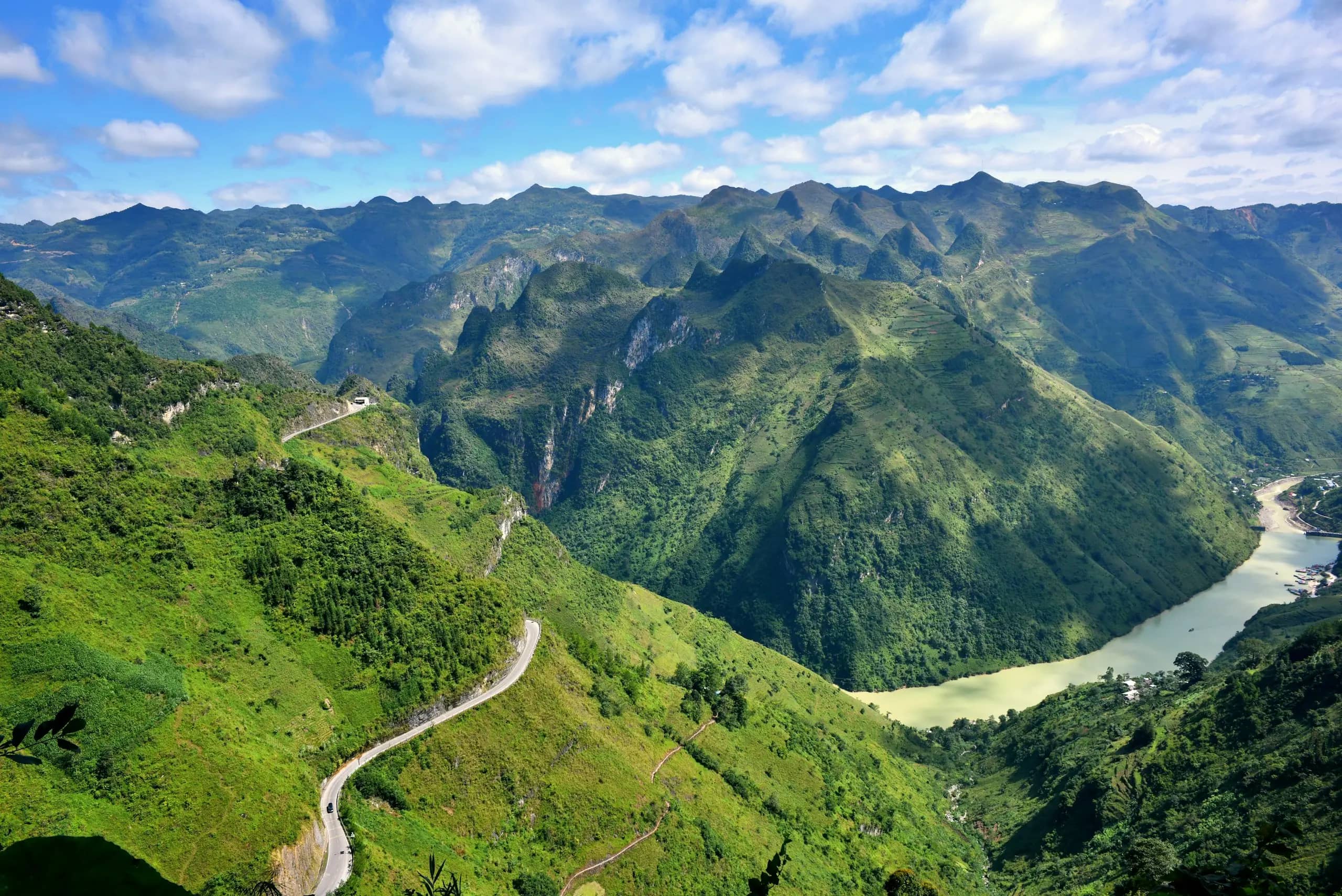
    A narrow road winds along green Ma Pi Leng slopes above the jade Nho Que River, karst peaks under a blue sky

    View · 30 min

    Ma Pi Leng pass

    Cost: Free

    Ma Pi Leng is the most famous stretch of the loop, about 20 km of road threaded between limestone towers above the emerald-green Nho Que river. Stop at the viewpoint by the Meo Vac visitor centre for the view straight down into the gorge. Ride it slowly and pull fully off the road to take photos: the road is narrow, with buses and trucks on the bends, and the drop is sheer. In fog, wait, or come back after lunch.

    Image: Ama Journey / Unsplash

    About 10 min by motorbike, 9 km. Down the side road to the river dock below the pass, a few kilometres.

  3. 10:153
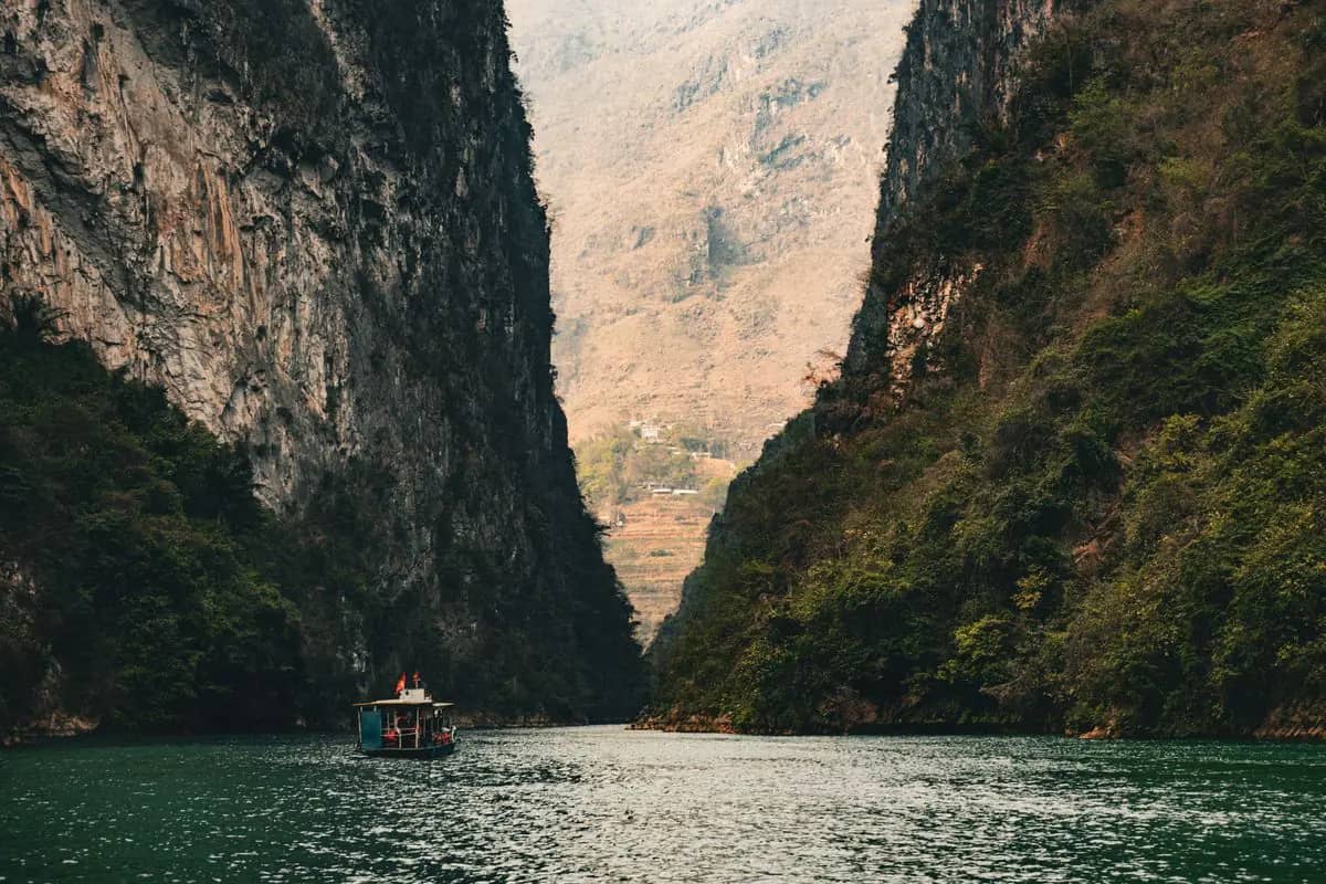
    A tour boat on the green Nho Que river at the foot of the sheer cliffs of the Tu San canyon

    Do · 1 h 30 min

    Boat on the Nho Que river

    Cost: Boat fare set at the dock; no official price published, so check there

    Trade the bike for a boat and see the gorge from the water: boats run up the emerald-green Nho Que between towering karst walls. Lonely Planet names two places to board, Ta Lang harbour, 5 km from Dong Van, and the dock at Xin Cai; ask your guide which they use. The dock below Ma Pi Leng, at Tu San, has a canteen. Wear the life jacket, and ask the price for the whole boat before you board.

    Image: Đức Trung Đào / Pexels

    About 10 min by motorbike, 9 km. About 15 km on to Meo Vac.

  4. 12:154

    Eat · 1 h

    Lunch in Meo Vac

    Cost: Prices per dish

    Meo Vac is a market town about 15 km from the pass and the last town before the long stretch to Du Gia, so eat and fill the tank here. Lonely Planet suggests spending a night here if you have extra days, at Auberge de Meo Vac, a restored Hmong house with rooms and dorms. On the three-day plan, this is where you turn west back to Ha Giang through Yen Minh, about 165 km, instead of going on to Du Gia.

    About 2 h 10 min by motorbike, 156 km. About 78 km south via Mau Due to Du Gia; the last 42 km are slow, allow 3 hours.

  5. 17:005

    Do · 45 min

    Du Gia waterfall

    Cost: Free

    Du Gia is a valley home to more than a dozen ethnic groups, and the waterfall is a 5-minute ride from the village: a green swimming hole for a sundowner after a long day on the bike. It can fill with tour groups and loud music, so if you want it quiet, come back early tomorrow. Do not swim after heavy rain, when the stream rises fast. From May to August, the rainy months, the road here can be slippery and muddy.

    About 10 min by motorbike, 2.8 km. Back to the village, about 5 minutes.

  6. 18:306

    Eat · 1 h 30 min

    Dinner at a Du Gia homestay

    Cost: Usually included on tours

    The last night is the rowdy one on group tours, with plenty of rice wine before the ride back, Lonely Planet warns. If you want a quiet night, ask your company for a small group or a homestay away from the main tour stops, or ride independently. Hand your passport over on arrival for the police declaration. Tomorrow is the shortest day, so there is time for a walk in the morning before you go.

Day 4

Du Gia back to Ha Giang city, about 85 km

A morning walk through Du Gia's rice terraces, a quieter road back past viewpoints and waterfalls, and the 0 km marker in Ha Giang city by early afternoon, in time for the bus.

07:30 to about 15:00 · 4 stops

12345 km
Numbers follow the plan below; solid lines by road, dotted on foot, dashed by boat, train or cable car. Map: © OpenStreetMap contributors, Natural Earth.
  1. 07:301
    Green rice fields and trees on the floor of the Du Gia valley, karst peaks wrapped in rain cloud behind

    Do · 1 h

    Du Gia rice terraces

    Cost: Free

    Villages on the loop are often treated as overnight stops only, so take an hour to walk through Du Gia's rice terraces before breakfast, while the valley is quiet. In September the rice turns gold. Keep to the field edges and paths, ask before photographing people, and close any gates behind you. Then pack up and set off: with an early start you are back in Ha Giang city in time for an afternoon bus.

    Image: Huy Chien Tran / Pexels

    About 35 min by motorbike, 9.2 km. North-east on DT176, about 8 km to the viewpoints above the valley.

  2. 09:002

    View · 30 min

    Viewpoints on DT176

    Cost: Free

    The road north-east out of Du Gia climbs past a string of roadside viewpoints, with Lung Ho, about 10 km from the village, the best known: a small roadside cafe with karst rocks to scramble on for photos. Lonely Planet's writer then pushes on about 40 km to A Boong waterfall, quieter than Du Gia's, for a quick dip, and suggests the old French stone fort near the junction of DT176 and DT181 as a detour. From there QL4C runs 35 km back to the city.

    About 1 h 35 min by motorbike, 77.1 km. About 75 km back to Ha Giang city by DT176 and QL4C.

  3. 13:003

    Eat · 1 h 30 min

    Back at Km 0 and lunch by the Lo River

    Cost: Prices per dish

    Back where you started. Take the end-of-loop photo at the 0 km marker on Nguyen Trai street, then eat along the Lo River, where a walking path runs past cafes built out over the water on concrete poles. Lonely Planet's writer celebrates with a beer at Top of the Loop. Return the bike, check it for damage with the shop, and collect your passport if you left it as a deposit.

    About 5 min by taxi or Grab, 3 km. Grab car to the southern bus station, 3 km, or wait for your bus company's pickup.

  4. 15:004

    Travel · 30 min

    Bus back to Hanoi

    Cost: Hanoi route fares from about VND 250,000 to 550,000

    Buses and limousines between Ha Giang and Hanoi take about six to seven hours, so an afternoon departure reaches Hanoi late in the evening; night buses arrive in the small hours. Bang Phan stops at the southern bus station, 3 km from the centre, and at its office at 100 Tran Phu; other companies leave from the bus station. Book the day before. Bang Phan and Quang Giang also run to Sa Pa, about 240 km away, if you are heading west.

Tips for Ha Giang Loop

  • Foreigners need a permit to enter Vietnam's border areas, and the loop runs through them. It is applied for through a sponsor, so ask your tour company or homestay to arrange it; without a sponsor you cannot get one, and entering without a permit can be fined 500,000 to 2,000,000 dong.
  • Do not ride yourself unless your licence is valid in Vietnam: rental shops ask for your passport, an international driving permit under the 1968 convention and your home licence, and police check riders on the loop. Otherwise ride pillion with an easy rider or hire a car and driver.
  • September to November is the best time: the rice turns gold in September and buckwheat flowers from October to November. From May to August roads are wet and slippery, and Ha Giang city averages 545 mm of rain in July.
  • Pack for cold from November to March: a heavy jacket, gloves and thermal layers. Bring spare dry clothes in the rainy months.
  • Do not arrive on a 3 a.m. night bus and ride the same morning: come a day early, or take a morning bus from Hanoi, about six to seven hours, and start rested.
  • Hand your passport to every homestay on arrival: hosts must declare foreign guests to the police, and Dong Van police check homestays on it.
  • Want fewer crowds? Ask for a small or private group that times stops early or late, or spend extra nights in Nam Dam, Lo Lo Chai or Meo Vac instead of the standard stops.

Getting there, where to stay and the weather by month are on the Ha Giang Loop page. Plan checked 24 October 2026.

Sources

Checked in October 2026.Show all 14 sources
  • lonelyplanet.com. Loop about 370 km round the Dong Van Karst Plateau; four days most common, some ride in three; legs Ha Giang to Yen Minh (about 90 km), Yen Minh to Dong Van (about 100 km), Dong Van to Du Gia (about 100 km), Du Gia to Ha Giang (about 85 km).
  • vietnam.travel. Vuong palace wood-framed in the traditional Chinese style; Lung Cu flag at the border, arrive late afternoon (Vietnam Tourism; place-ha-giang row 12); palace date 1902 (Vietnam Tourism) against the 1920s (Lonely Planet), noted in place-ha-giang.
  • quocviet.langson.gov.vn. Foreigners need a permit for border areas (Tuyen Quang police, 31 May 2026); campaign across 17 border communes in the Dong Van geopark; permit through a sponsor only; entering without a permit fined 500,000 to 2,000,000 dong (place-ha-giang rows 4, 5, 7).
  • congan.tuyenquang.gov.vn. Homestays must declare foreign guests' temporary residence; Dong Van commune police checking homestays (place-ha-giang row 6 and hand-check notes, Báo Tuyên Quang 22 September 2026).
  • looptrails.com. Rental shops ask for the original passport, a 1968-convention IDP and the home licence (Loop Trails; place-ha-giang row 32).
  • datafiles.chinhphu.vn. Ha Giang station rain July 545.3 mm (place-ha-giang row 14).
  • en.nbca.gov.vn. Dong Van Karst Plateau UNESCO Global Geopark, recognised 2010, four districts Quan Ba, Yen Minh, Dong Van, Meo Vac (place-ha-giang row 13).
  • xebangphan.vn. Bang Phan stops at the bus station and its office at 100 Tran Phu; Hanoi route fares VND 250,000 to 550,000; Sa Pa to Ha Giang 240 km (place-ha-giang rows 25, 26); Quang Giang Ha Giang to Sa Pa from the bus station (place-sa-pa row 29).
  • router.project-osrm.org. Southern bus station 3 km from the centre; city to Bac Sum 28 km; city to Heaven Gate 46 km (place-ha-giang row 34).
  • router.project-osrm.org. Road distances (OSRM, our queries): city, Heaven Gate, Yen Minh 97.5 km; Heaven Gate to Lung Tam 11.1 km, Lung Tam to Yen Minh 42.6 km; Yen Minh, Vuong Palace, Lung Cu, Dong Van 93.3 km (32.1, 35.4, 25.8); Dong Van to the Youth Volunteers Monument 8.5 km; Dong Van, Ma Pi Leng, Meo Vac 22.3 km; Meo Vac to Mau Due 34.7 km and Mau Due to Du Gia 42.2 km, 157 min in all; Meo Vac back to Ha Giang via Yen Minh 164.5 km.
  • reddit.com. Stops every 30 to 40 minutes, never driving more than an hour (place-ha-giang row C2).
  • reddit.com. Smaller company, private group, arriving very early or after everyone else (place-ha-giang row C3).
  • api.sunrise-sunset.org. Sunset at the Dong Van fort on 15 November 2026: 17:14 (computed).
  • openstreetmap.org. Coordinates (OSM): Km0 Ha Giang node 7958012224; Bac Sum viewpoint node 5516818522; Heaven Gate node 5388531822; Nui Co Tien viewpoint node 4427121492; Tam Son node 14247033699; Lung Tam Linen Cooperative node 5417771221; Yen Minh relation 19341521; Dinh Vua Meo node 7975480201; Lo Lo Chai node 7962462262; Cot co Lung Cu way 504649258; Pho co Dong Van node 7961606192; Phao dai Don Cao node 4333176791; Ethnic house node 14218758401; Young Volunteers Monument node 5402735628; Ma Pi Leng viewpoint node 3282165789; Tu San boat dock canteen node 7418418185; Meo Vac relation 19331599; Du Gia Waterfalls node 5447121623; Du Gia relation 19325708; DT176 viewpoint node 10314270710; Ha Giang city node 14109370955; southern bus station way 853242791.